Latest Strava Update Caters To Hikers
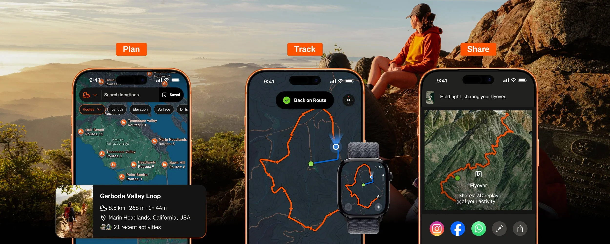
Popular running and cycling app Strava has noticed an influx of hikers (Strava’s own Year In Sport report finding that 2025 saw a 5.8x increase in hiking clubs) using the app to track their adventures, so their latest update (467.0.0) adds new features to cater to them. Route Discovery lets you see what popular trails are in your area, and Route Builder lets you plan your adventures before heading out.
Planning
[NEW] Map style improvements - launching later this summer, athletes will be able to view richer trail surface data, along with clearer points of interest like trailheads, picnic areas, and campgrounds that makes dense trail networks legible at a glance
Route Discovery - surface popular routes in any area, powered by Strava’s global heatmap of activity data, so athletes can find trails wherever they go (subscribers only)
Route Builder - plan custom hikes with live distance, elevation, and surface feedback as you draw, including trail-specific map styles (subscribers only)
[NEW] Route Saves - save routes from a number of in-product surfaces (Activity Detail Page; Route Detail Page; Route Builder; Edit Route) and access them directly within Strava (subscribers only)
Tracking
[NEW] Off-Route Alerts - notifies athletes when they stray from a planned route, so they can course-correct before getting lost (subscribers only)
Route Following on Apple Watch - navigate directly on your wrist, no phone required.
Smart Watch Route Sync - routes built in Strava sync directly to compatible Garmin, Apple Watch and Coros devices for seamless navigation
Offline Routes - download routes for use in low- or no-connectivity areas, so cell dead zones don’t mean navigational dead ends (subscribers only)
Mobile Record Map - a fullscreen map accessible through 1 tap during recording gives athletes a clearer, more detailed picture of their route in real time
Live Elevation - see elevation profile data as you move, helping athletes pace themselves on climbs and plan effort across the full route
3D Activity Map - view your hike in feed as a 3D landscape, with topography and elevation rendered in detail
Sharing
[NEW] Activity Replays - set your hike to auto-animate in your feed, replaying your route for friends from start to finish (subscribers only)
Sticker stats - share your hike's distance, elevation, and time with friends as a social-ready overlay
Clubs - hiking-focused clubs give trail communities a home on Strava, with shared routes, group challenges, and leaderboards
Flyover - a cinematic 3D aerial animation of your completed route, rendered from real elevation data, giving every hike a highlight-reel moment worth sharing (subscribers only)
Download the app for free and let us know what you think! I’ve enjoyed it for both trail running and cycling, but as some of these newer features get added, it might lend itself well for hiking too.