Ontario Parks Releases Official QEII Camping, Canoeing & Campsite Map


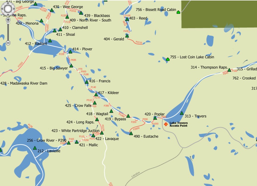
Ontario Parks released their official camping, canoeing and campsite map for the Queen Elizabeth II Wildlands Provincial Park. It shows access points (and the roads to get to them), portages and points of interest.
“This Geo-referenced map has the ability to follow your progress, if used with an enabled app on your mobile devices. 100m points have been built into the image to help manage distances while hiking and canoeing.
The map will evolve through time, so make sure that you continue to monitor for changes and keep the most up to date version on your devices. ”
Download the latest version via .PDF via the Ontario Parks website.
Stay connected with Ontario Parks by following them on Facebook, Instagram and Twitter.
Evan Holt