Ontario Provincial Police Recommend Installing What3words


Recently the Ontario Provincial Police have been recommending that people install the app what3words on their cellular phones to assist in emergencies. In the last few weeks alone, success stories include finding lost hikers in Pinery Provincial Park and at Lion’s Head Conservation Area.
Currently the number two navigation app in the Apple App Store, what3words (free to download on the Apple App Store and the Google Play store) maps the entire world into 3 meter squares and gives each square a unique combination of three words.
“The what3words app offers precise location information when a caller cannot describe, or does not know, where they are. This exciting technology may help save precious time in an emergency and enable a more rapid frontline response.”
There are many reasons this concept works well…

If you’re completely lost, the three words will narrow down your location for emergency teams to a three meter area. A far more accurate method than giving a street address, especially when you are most likely not lost/injured right along the roadside
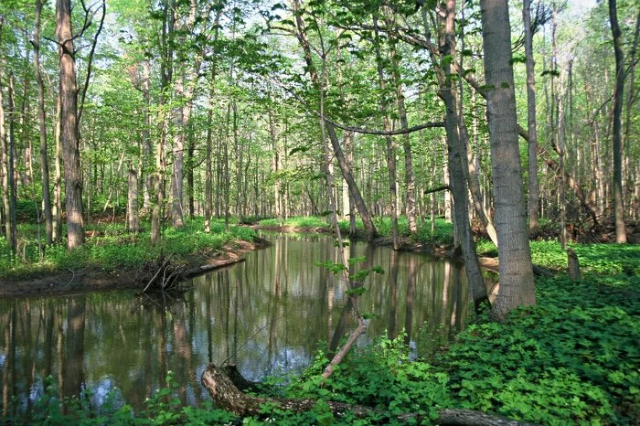
If you are located somewhere in the woods along a trail, this will help emergency teams plan the most direct route to you. Much better than passing along a street address
It’s a very concise way of communicating your location. Say you needed medical help along the 15km Lakeshore Hiking Trail in Silent Lake Provincial Park. It would be far easier to share that you are at tweets.sketchbook.greenbelt than trying to verbally pass along a long GPS co-ordinates 44.900076,-78.0439848.
The simplicity is aimed to reduce call times at emergency services
The app has all of the geodata built-in, so as long as you have it on your phone, you don’t need a connection to retrieve the three words.
Current mapping/GPS apps already let you share you location, but when communicating with help you are usually calling via phone service. This app helps bridge the gap.
It’s a smallish download at 130MB compared to other mapping apps which also assists when time is a factor.
Where the concept isn’t perfect is that If you don’t have a cell connection, you still need a way to communicate the three words to help in order for it to have any benefit. While many situations in the backcountry won’t benefit from this app, you can’t discount that it could help someone in dire straights due to the simplicity of locating them with such plain wording. Three words are easy to pass from one canoeist to another than trying to remember which nook of a lake that someone is stranded at.
I know that in the backcountry camping community that it is easy to dismiss the app saying that if you’re truly interested in your safety that you should have bought a satellite communications device. A free app is a far cry than a device that costs hundreds of dollars and requires a monthly subscription fee. They aren’t aimed at the same audience. This app can assist from getting stuck in a snowbank on the way to a park, to being many kilometres on or off of a trail.
“We all know that emergencies can happen anywhere, at any time. With this tool, the OPP’s PCCs will be able to help officers locate callers who are unaware of their exact locations, including in wooded areas and on waterways.”
Various police services in Manitoba, New Brunswick, Nova Scotia, British Columbia and Alberta have all been using the service as well.