Interview With Piotr, Creator Of WristTopo
I’ve been using the WristTopo app now for about half a year and absolutely love it. Despite owning an Apple Watch Ultra, there’s a huge gap in apps that utilize its amazing features. Once I started using WristTopo, I put it right on my watch face so that it was always a tap away (although I could easily have made it my action button function as well). The app is very responsive, and zooming in and out to see your location, route, offline maps, imported .GPX routes and more made registering it a no-brainer for me. I tracked down the app developer Piotr and asked him if he would share more about how the app came to be, what developing it was like, and where the app is headed in the future… he was more than happy to share the journey…
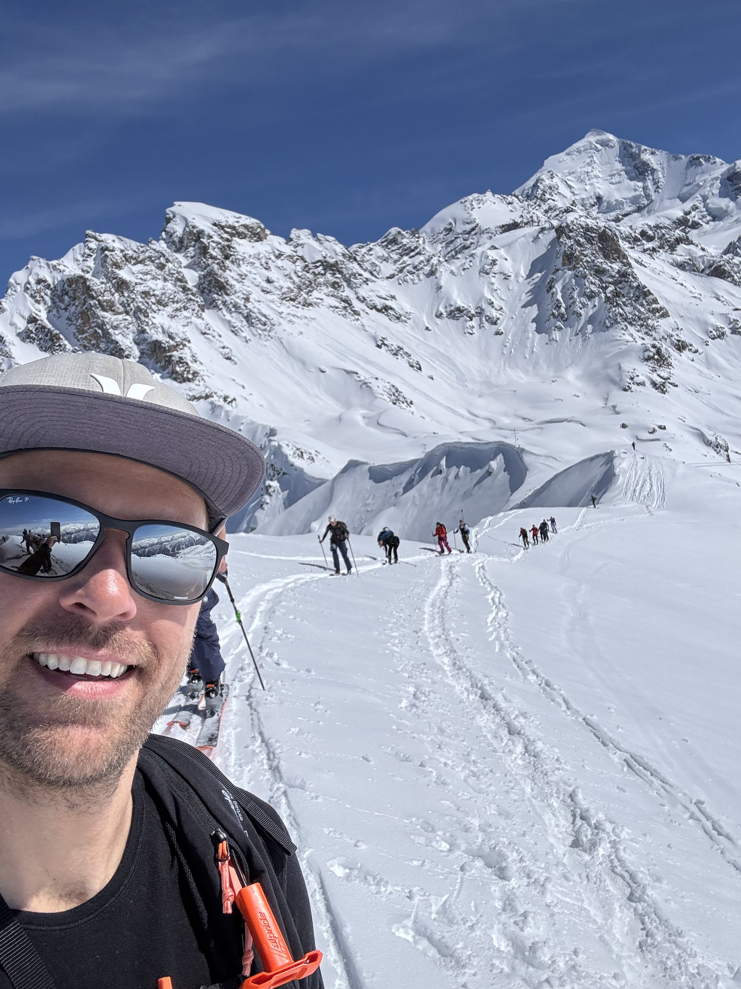
The spark of inspiration came from actual need. My biggest hobby and passion is backcountry skiing (I actually spent 3 winters in Canada and loved it, Revelstoke and twice in Whistler – 2016 in Revelstoke was likely one of the best seasons of my life :)). And while doing it, you rarely follow visible summer paths or roads, as everything is covered in snow, and often winter routes take totally different paths for safety. GPS technology and GPX routes are huge in this sport. Being able to validate that you’re in the right spot really opens many options and is a big safety benefit.
Phones are already great for that, but constantly pulling out the phone from your pocket (or even backpack), taking off gloves, and fiddling with it in freezing conditions is not optimal. So sport watches came as an obvious alternative. But once, I was skiing with my friend with his Garmin Fenix 5 or 6 in a total whiteout, and the experience was terrible. The fog was so bad, we barely knew what was up or down, and had to check our position every few turns. But his watch would constantly zoom out after we moved. So he had to zoom in and pan again every few turns to get enough precision. Generally, it all felt extremely clunky. At that point, I knew Garmin was not really what I was looking for, haha. They surely got better over time, but I owned a Garmin without maps at that time too, and I just didn’t like their software. It felt clunky, overloaded with data, but difficult to dig out the useful bits that mattered to me.
Around that time, my girlfriend bought an Apple Watch for herself. I borrowed it for a few trips to test it. Mapping on the Watch wasn’t perfect either, but it seemed way better than Garmin. And I felt there was huge potential given the hardware capabilities. There must be something better out there… or there will be one day. So I bought the Ultra when it was released. But my hopes for something significantly better were not really fulfilled over the years. I used workout apps with maps, they worked fine, but I was always surprised why not better. And I was missing specific workflows for my needs, more focused on mapping than workout statistics.
Being a programmer, I did some research and found a big part of the answer. There are basically no mapping frameworks for WatchOS (apart from Apple’s own MapKit that cannot accept custom maps). While lots of code and libraries can be shared between iOS and WatchOS, that’s not the case with mapping tools. Setting up a map in an iOS app can take a single day, because you’re using prebuilt blocks and tools. But on WatchOS, you’re completely on your own. And mapping is not that easy. There are plenty of thoughts and details to figure out: how to deal with networking, when to download map fragments, how to cache them, how to make everything look smooth and fast, and so on. I believe that’s why there are barely any WatchOS maps out there, and if they exist, they work as they do.
So that was the moment I got really interested in trying to code my own map for WatchOS. Most programmers would absolutely hate it. But weirdly, I love this kind of challenge. Solving some complex problems in smaller scale, focusing on these hidden details, maximizing performance and usability. Most of my professional life I’ve been developing physical simulations for education, so while the topic feels different, it actually shares a lot of these characteristics. And some of them even touched mapping quite a lot (for example, earthquake mapping tools). So I was very familiar with some concepts. But at that time, I was still completing my 10th or 11th year of working for the same company as a full-stack developer. And working full-time while trying to be outdoors as much as possible, including chasing powder snow, I didn’t have much time to pursue a side project.
Fast forward to fall 2024. My company laid off plenty of people as it lost its funding, and I was in this group. Suddenly, I had lots of time. And I didn’t want to jump straight into the next job after working for 12 years non-stop for one company. I wanted to give myself time to breathe and explore what I’d like to do.

And that’s when I started working on WristTopo. Not that it was my idea for the next job. Not at all. I was enjoying my freedom, but I wanted to keep the brain a bit busy and learn new technology (I was not an iOS developer). I started with a Watch-only proof of concept. It took me a few months to come up with the first version, but I was actually pretty happy with the results. I also found myself really enjoying Apple technologies that were in some sense very similar to what I was using before. And I think having a slightly different perspective and past experience weirdly put me in some advantage. I might have gotten some concepts of the most recent Apple tech faster than a person who had been in the iOS ecosystem forever.
So I decided to publish the app to the App Store in 2025 and see what happens, with zero expectations. It started slowly, but once in a while I started receiving feedback from users saying they really enjoyed it, along with useful tips and ideas for new features. Later on, I had a few bursts of user acquisition and feedback, usually when I randomly got mentioned on some popular websites. That was a big factor. I realized how satisfying it is to be in charge of the complete software cycle – from idea, to design, to implementation, then talking to users, and implementing their feedback. This is very different from being a small cog in a big software machinery. My software doesn’t fly to Mars, but this complete process and the conversations gave me joy I hadn’t had for years.
And I think that was the turning point when I really started to push the development and realized this could be my new, extremely satisfying job. And here we are today. I don’t know yet if that’s true, but given the response in my own country, Poland, and neighboring Germany (both countries somehow loved the app the most, hehe), I really hope to make that dream come true.
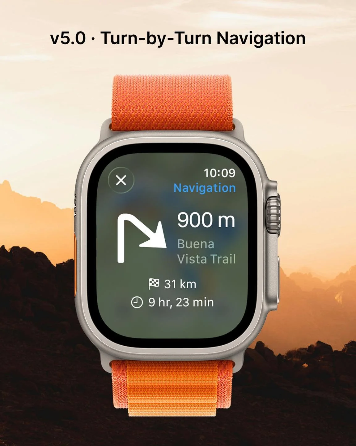
My list of planned features is becoming pretty long. But I want to always stay true to the core idea of keeping the app clean, fast and useful. So even if I add more specialized features over time, I’ll always make sure not to clutter the experience for everyone. Currently, at the top of my list is turn-by-turn navigation and on/off-route alerts for tracks that cannot use turn-by-turn. Some users asked about it, and it clearly fits the app, but also because it’s challenging and fun to work on. I’d like to make it discrete and fitting for the outdoor focus of the app. Later on, a quite common request is around custom waypoints and Strava integration (ability to pull routes directly from Strava). Long-term, I think the ability to have more map types and layers could be interesting, but it would definitely be a configurable option. At this point, I receive feedback from users quite often, so the list of features is largely built on that basis and changes often. If I hear some awesome idea tomorrow, I might shift my priorities completely. And I hope it stays like that!
Give WristTopo a try today, I’m sure you will love it!