'Maps By Jeff' Announces The Long Awaited Algonquin Map

It has probably been about five years in the making, but map maker Jeffrey McMurtrie has finally taken the wraps off the long awaited Algonquin Park canoeing map. After recently announcing the rebranding of his business “Unlostify” to “Maps by Jeff”, each day he has teased some cool new features coming to the map.
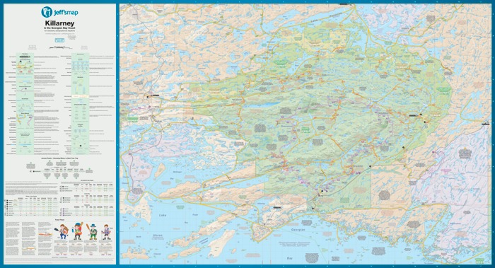
We had a sneak peek at the map and we were immediately pleased with how clean and tidy the maps looks. You can see the amount of time and effort that has gone in to it to ensure it offers a chock load of information, while also balancing the layout so that things aren’t cluttered. The colours have also been toned down since the Unlostify days (although funnily enough, that’s still the same shade of green as used on the original maps), and contour lines are present but artistically muted that you don’t even notice them at first glance (but they are available and appreciated by those that use them). The distance markers return to a simple time estimate, and markers for points of interest have really been fleshed out.

We asked Jeff what his favourite new feature was and he mentioned it was the portage elevation plots and hills. On prior maps there was simply a time estimate that the average tripper would take and that’s all you had to go on… but the new map “gives a whole new perspective on portages.”
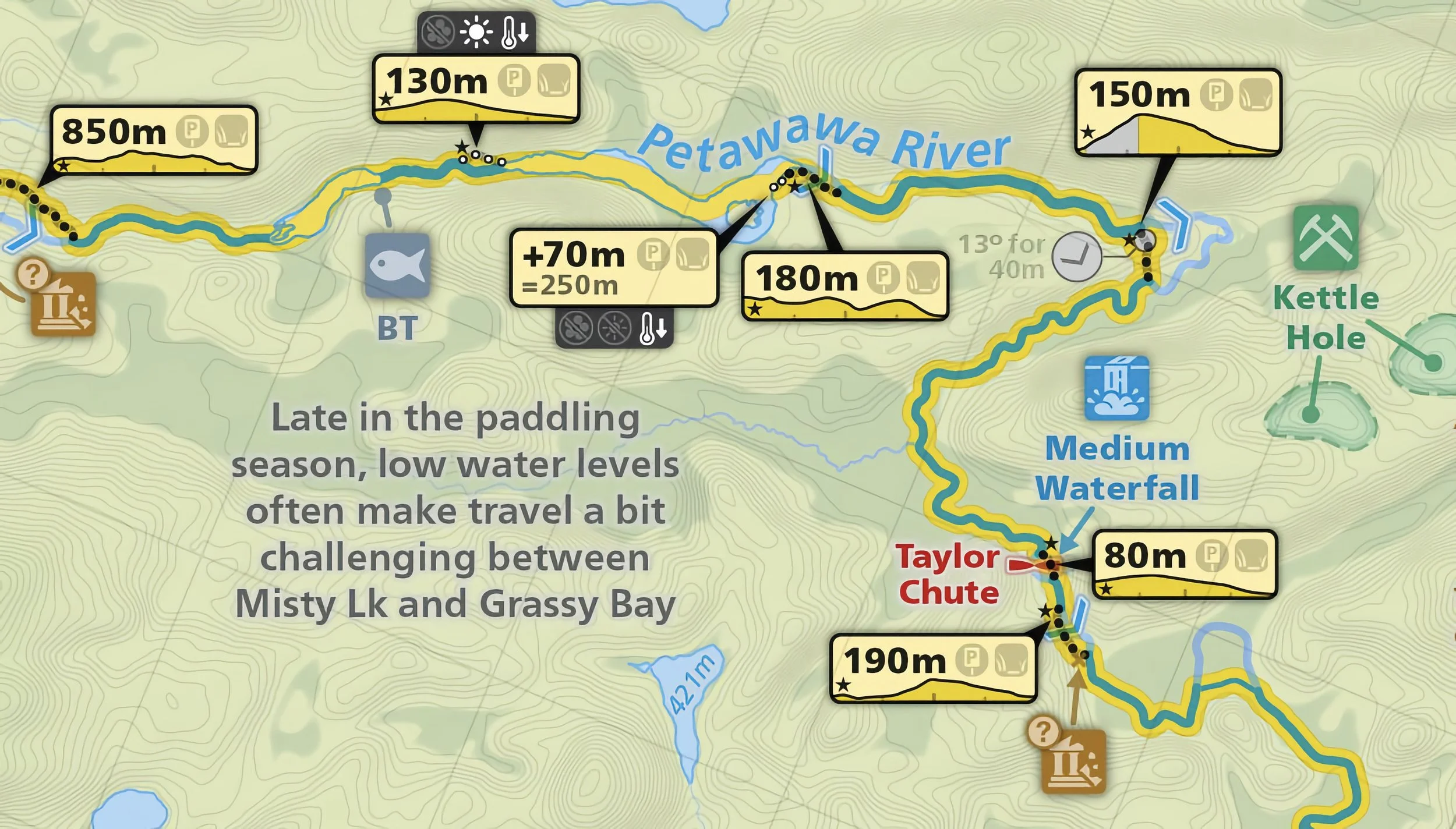
“That was the toughest feature I’ve ever created, but I’m incredibly happy with how it turned out.
Behind the scenes it uses hundreds of GPS tracks that people have sent me over the years. We learned how to program so that we could take the raw tracks, extract the portages, find the hills and plot the graphs.”
Now there will be no surprises next time you are planning your route, or you arrive at a portage and what to know what you’re up against. Jeffery reminisces that the portage project alone probably took him eight months to complete. When you scratch your head as to how on earth a map can take so long to make consider this…
“It’s not so much that I say “let’s toss the old design and start over again!” but rather than I have a list of problems/things that I want to improve. Once you tweak one thing, and then another and then another, suddenly you have a new design.
Here’s an example; one challenge I’ve always been trying to tackle is readability – both where there’s a lot of info in a tight space, or when lighting conditions are poor.
So, I might tweak the obstruction (rapids, falls, dams, etc) design to make them a bit bigger because I find that they’re too easy to miss. But then, I find that when they’re near portages they over up/block out the portages. So I need to tweak the portages/canoe route lines in response. And suddenly I’ll have changed 5 different elements, all because I wanted to make sure that people wouldn’t miss seeing a waterfall.”

The physical maps are actually being folder as we post this article and will go ‘live’ shortly. Anyone who buys a map gets all the different formats:
waterproof printed copy
a Garmin 'Custom Map' file
an Avenza Maps (for iOS/Android) compatible file
a Google Earth file
a high resolution JPEG, perfect for making enlargements
Stay connected with Maps by Jeff by following them on Facebook and Instagram.