
Interview: Gill and Tony Daffern, Authors of the Kananaskis Country Trail Guide
I recently had a chance to chat with Gill and Tony Daffern to learn more of the back story about the Kananaskis Country Trail Guide.
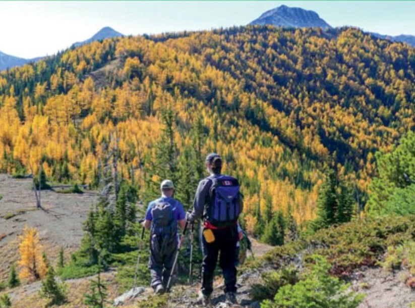
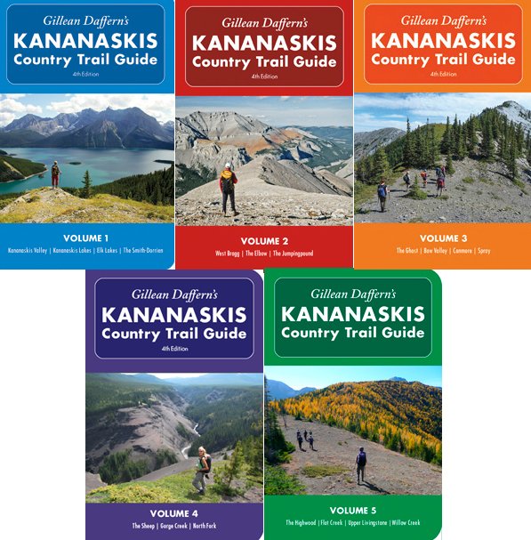
Gill and Tony were driving back from a party one night and were joking with each other that "someone should create a trail guide for this area". Gill decided that she would tackle the challenge and that idea transformed into the The Kananaskis Country Trail Guide which was published in 1979 just after Kananaskis Country was announced and only cost $5.95. They typed the books on an Apple II, then sent the finished work to a local guy who typeset it onto forms. From there over the years the single book developed into two books, and now recently the finishing touches were put on the fifth volume of the series which together now impressively includes 1520 pages covering 435 hikes with 451 options.
Each of the trail guides has a set of maps (between six and nine, depending on the guide) at the back of the book which depict the non-motorized trails of Kananaskis Country. Originally the data came from their GPS tracks and were made into 1:50,000 scale maps which they drew in Adobe Illustrator. They would then print the map on a 11 x 17" piece of paper which reduced neatly to fit in the back of the books, however they felt that the maps were kind of small. To celebrate the completion of the five volume series which has taken Gill over six years, they are now releasing the maps as downloadable files so that you can print them on an even larger paper sizes.

Gill and Tony have also run into other issues over the years finding that a lot of the existing topographic maps at the time were very inaccurate (lots of side valleys and mountains simply aren't even on the topos) so they have been trying to alter their maps to take this into account. Tony was also puzzled when the GPS tracks were fitting over top of the topo maps and yet the town of Canmore wasn't matching up. He couldn't quite figure out why. Tony later concluded that someone at some time displaced the city by a few hundred feet for the topo and it was never corrected.
A great time waster was also dealing with 1:50,000 maps that were on the market as half of them were in imperial, while the other half were metric (Imperial contours are 100 ft intervals and metric are 40 m intervals). It required a lot of photoshopping to get the contours to meet to create a basis for their own maps.

GPS has made everything so much more accurate but in some ways also has created more work for them. "We tend to wander all over the place sometimes so I have to clean up the GPS track logs for publication," jokes Tony. "But it has certainly made things more accurate. In the first three editions most of the lines on the map were were put on by Gill's notes where as now I can put those lines on pretty accurately.". Back in the early stages the government wouldn't allow you to reproduce their topo maps, but eventually relented on those restrictions. Their workflow involved using a program called MacGPS to stitch all the maps together and output them to .PDF, then import the .PDF file into Adobe Photoshop to cut them into page sized pieces. "It was a process we got quite good at over time" says Tony. "It's noticeable to me that from the first volume to the last one, that we got much better at producing the maps and cutting them up.".
They find that some of the data from Google Earth is also finally good enough resolution that it is an actual benefit for hikers (although "a little spotty in the Rockies"). They have also been crowdsourcing GPS tracks from fellow hikers as well to continuously update their own maps.
Despite Gill having to put her work on hold for an entire year in 2013 due to the Kananaskis floods there was an interesting story to come out of it. By comparing the original topo maps to the Google Map imagery which came out after the flood, you could actually see where a couple of the the rivers had reverted back to the 1920's channels.
Be sure to head over to their website for the latest Kananaskis Country news, to take part in their discussion forums and to purchase a copy of their books and download the maps. Stay connected with them by following them on Twitter.


